5 Top Cycling Climbs In The Yorkshire Dales
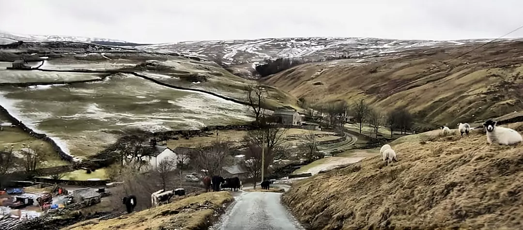
The English counties of Yorkshire offer arguably some of the best road cycling in the United Kingdom. The Hills of the Pennines with the Yorkshire Dales and the Northern edge of the Peak District were visually showcased by the Tour de France in 2014. Even with that exposure, there’s significantly more to cycling in Yorkshire than just the route the Tour riders passed over.
Challenge Yourself With The Top Cycling Climbs In The Yorkshire Dales!
One of England’s networks of National Parks, the Yorkshire Dales is an area of outstanding natural beauty. The area encompasses the town of Skipton in the South, up to its border with the A66 road which crosses the Pennines in the North. With the M6 Motorway to the west and A1 to the east of the area accessibility to some of Yorkshire’s best cycling climbs couldn’t be easier. Whether you are looking for some exercise or a great scenic route, you’ll find that the following will meet your expectations.
Also Read: Road Cycling Tour Of The Best Places To Visit In Sherwood Forest
Buttertubs Pass: A challenging road cycling climb
Tackled by the 2014 Tour de France as part of the Grand Depart in Yorkshire, Buttertubs Pass connects Wensleydale to Swaledale by cutting between Great Shunner Fell and Abbotside Common. Its name is derived from a section of 20-metre-deep limestone potholes named the Buttertubs after local farmers on their way to market would drop their butter into the holes to keep it cool on warm days.
The climb of Buttertubs Pass is an epic from either Hawes to the South or from Thwaite in the North. It is at its most challenging when tackled from the North from the B6270 road where the climb to the top of Buttertubs pass is just over 3.5 kilometres in length, with a number of sections where the gradient hits over 10%. The climb also features a short section of hairpins where the road ramps up to a lung-busting 25%.
From the B6270 road turn onto Cliff Gate Road (signposted Hawes). It’s here that the real work begins with a climb which doesn’t allow the rider to get into their rhythm. The road climbs for 1.5 kilometres before kicking up to throw a series of steep hairpins at you where the gradient maxes out at about 25%.
To your left, the hill drops away dramatically to showcase a deep valley as you arrive at a cattle grid which marks the top of the first section of the climb. From here you get a slingshot for a few hundred metres downhill to the start of the second part of the climb.
The final section of Buttertubs pass starts steadily before ramping up to around 20% as you draw towards the summit and another cattle grid to negotiate before a fast descent down into the town of Hawes. For the masochist amongst us that leads nicely to the next climb of the day: Fleet Moss and the highest road in Yorkshire.
Summit grid reference SD 8745 9096
Fleet Moss: Hardest climb in the Yorkshire Dales
The climb of Fleet Moss is another cycling epic. Measuring nearly 5.5 kilometres of climbing there’s no respite from the gradient on the highest road in Yorkshire.
From the B6255 in Hawes take the turning for Gayle and the Wensleydale Creamery beside the Primary School onto Gayle Lane and through to the village where the road narrows as you cross the river, from where the climb begins.
It’s a pretty sudden rise up to almost 20% elevation as you start to climb out of Gayle before the gradient eases and you pass a selection of farms. It can be a pretty dirty road as a result of all the agricultural vehicle use.
The road continues for a couple of kilometres, gently rising in elevation. The scenery gets more and more dramatic the further you travel up Beggerman’s Road, where the view becomes more imposing.
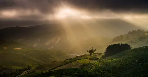
From the three-kilometre point, the hill kicks up dramatically aiming straight for the top of the distant ridge. The relentless gradient over the exposed moorland takes its toll on the rider. You have nowhere to hide and you must persevere onwards and upwards. Eventually, you’ll reach a plateau which showcases the Yorkshire Dales in all their glory before a final kick up towards what feels like the top of the world.
With an elevation gain of 338 metres, your lungs will feel like you’re in the Alps. Worth it? Definitely!
Summit grid reference is SD 8698 8986
Malham Cove: A short yet challenging cycling climb
At the Southern end of the Dales close to the town of Settle lies the climb of Malham Cove. Following Cove Road North out of the village of Malham you pass the Buck Inn Public House beside the public toilets and follow the gently climbing narrow lane out of the village.
On the outskirts of the village, the road kicks up viciously to around 15% gradient to start testing your legs. A series of steep, trying switchbacks then ensues; conquering each one is a small victory.
While only around 1.7 kilometres in length, the climb of Malham Cove is a challenge for anyone. It features sections that hit up to 20% in places before easing, and then steepening again as the road snakes its way past the natural amphitheatre of Malham Cove and up onto to the top of Ewe Moor.
In total a cyclist gains 180 metres of altitude and you can find the summit at Grid reference SD 9007 6267
Langcliffe Scar Cycling Climb
Climbing out of the North Yorkshire town of Settle, the climb of Langcliffe Scar can be tackled from Langcliffe or round via Stainforth. The climb is at its toughest when ridden from Langcliffe village just north of Settle off the B6479.
The road through Langcliffe rises gently along Main Street before starting to kick up after you exit the village. The road reaches an incline of up to 15% here taking you over a cattle grid between farm buildings.
After the cattle grid comes a series of strength-sapping hairpins where the gradient hits around 20%, before a further set of twists at around 15%. By the end of these sections, it will appear that the summit is in sight, however, it’s a false summit and a further section of easier climbing will take you up to the true peak of Langcliffe Scar.
The climb lasts for almost 2.5 kilometres and the summit can be found at grid reference SD 8207 6505
Also Read: How Do You Ride a Bike Uphill
Park Rash Cycling Climb
Although relatively short, Park Rash has to be up there with Yorkshire’s toughest cycling climbs. From the outset, it looks imposing with a dramatic, sweeping, vertical s-bend which seems to defy logic.
The climb starts just northeast of the village of Kettlewell where the road meanders gently uphill along Cam Gil Road through Coverdale until the road climbs away from Kettlewell Beck, up a nasty incline of around 20% that feels more like 30-40%. You may well be tempted to keep yourself upright by grabbing the rail alongside you.
There’s little respite in site as the road rounds the bend on a rugged weathered surface. The gradient starts to ease as the road condition improves before a final sting in the tail of the climb where the road hits 20% gradient again before passing over a cattle grid to signify the end is in sight.
The Climb of Park Rash gains an impressive 303 metres from Kettlewell and its summit can be found at grid reference SE1572 6551.
Are any Yorkshire cycling climbs that should’ve made this list? Feel free to leave a comment in the section below. Thanks for reading!

Steve Beck is a passionate cyclist and experienced writer covering the cycling industry for over a decade. He has a wealth of knowledge and expertise in all bike-related things, from the latest products and technologies to the best routes and trails. His articles are well-researched, informative, and engaging, and he has a talent for explaining complex cycling concepts in a way that is easy to understand. Steve can be found on the road when he’s not writing about bikes, putting his knowledge and skills to the test.





Fleet Moss definitely the hardest I have done in Yorkshire. Greenhow Hill out of Pateley Bridge deserves to be on the list.
Totally agree although personally will probably never do it. As child lived near here and we were always told it was the steepest hill in England.